Terrain analysis (everything)
tr_terrain_analysis
What it does
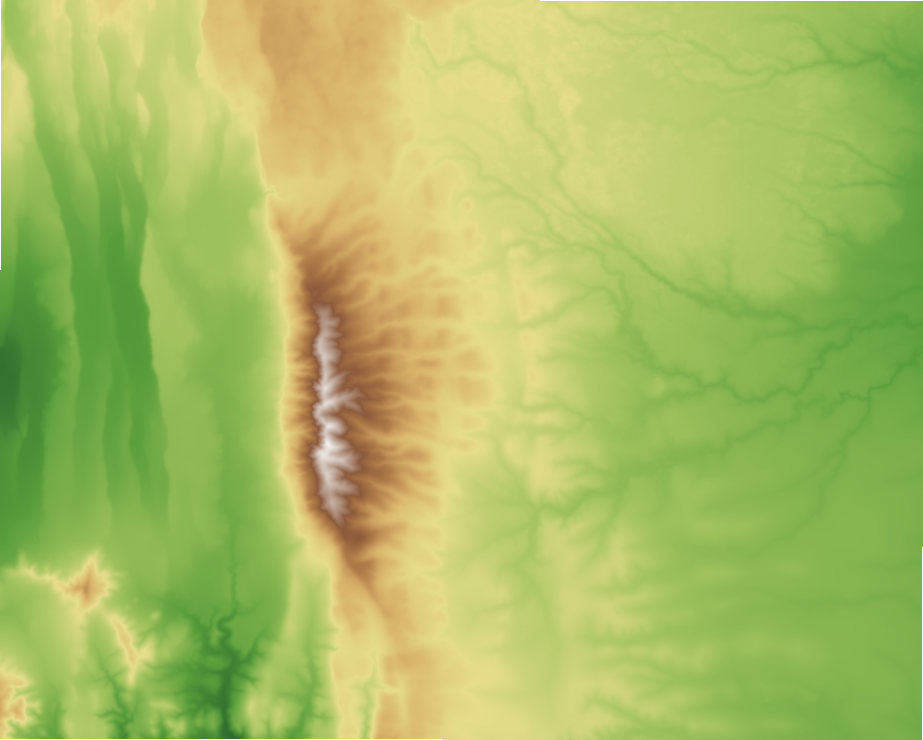
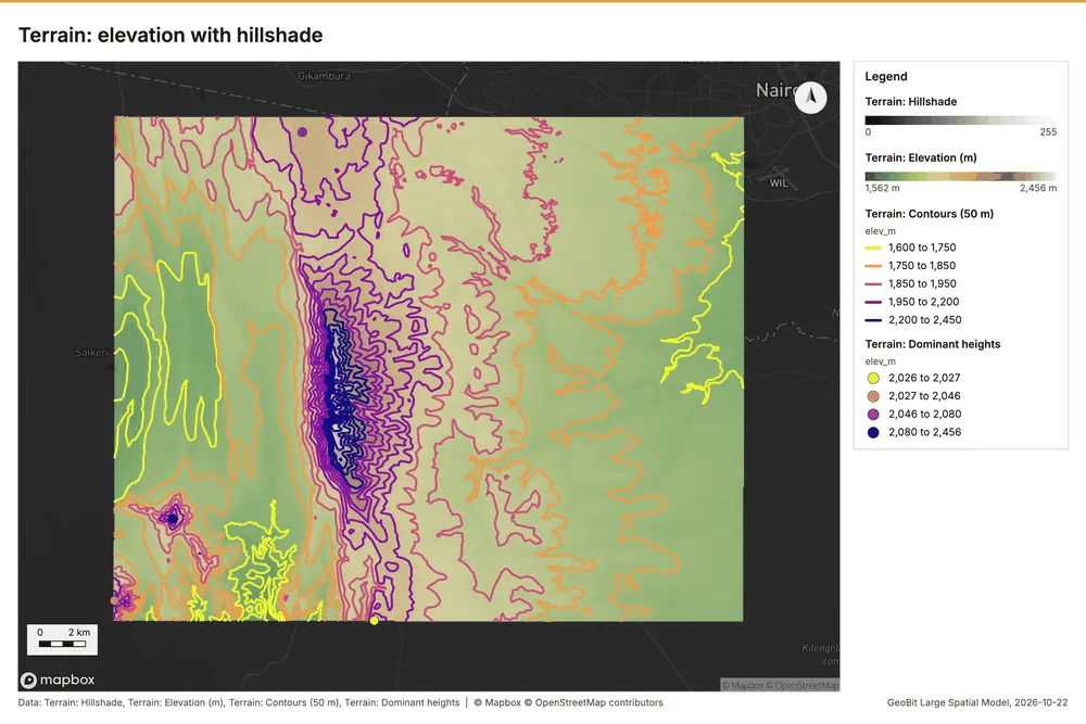
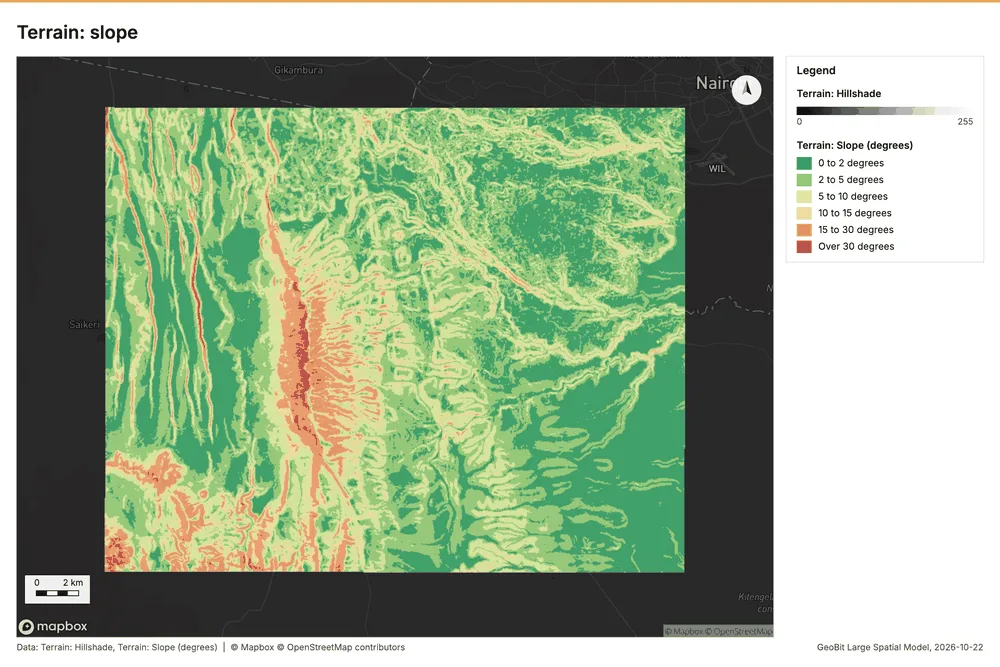
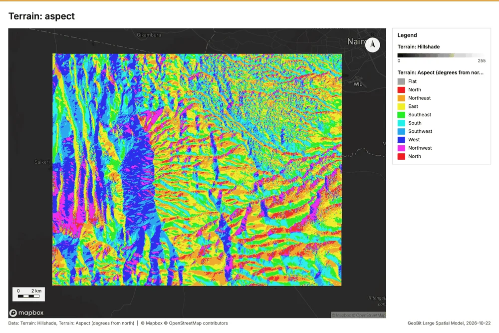
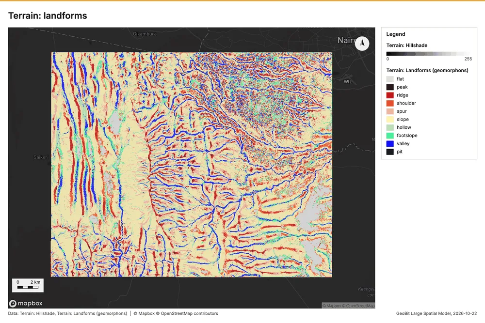
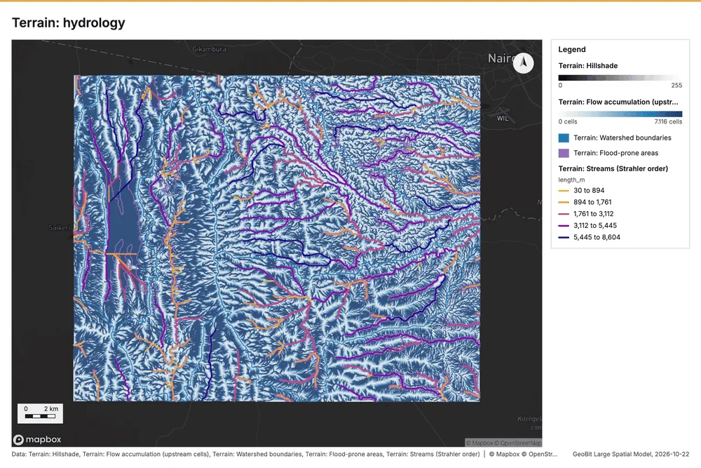
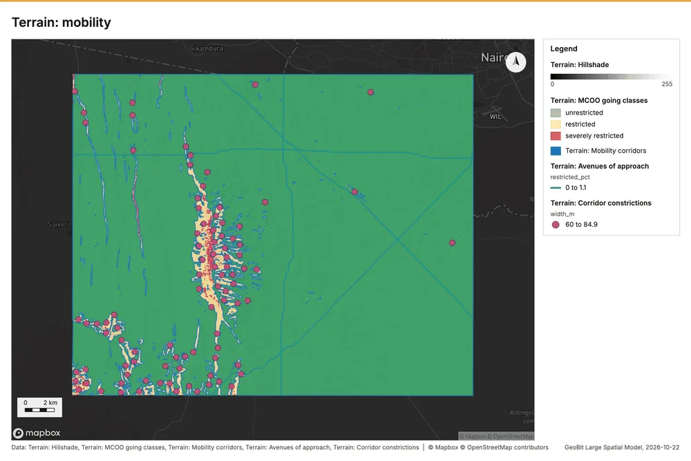
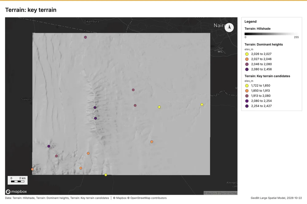
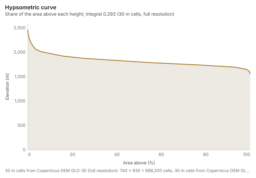
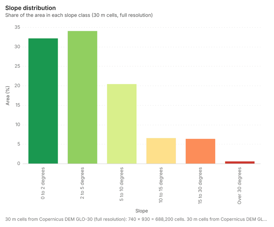
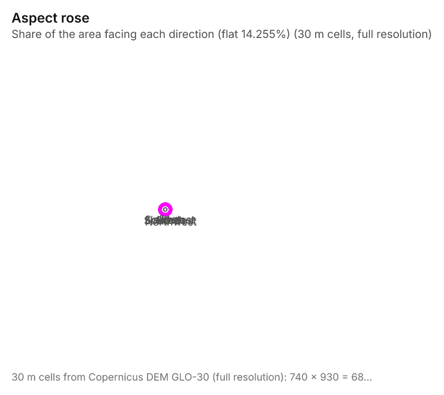
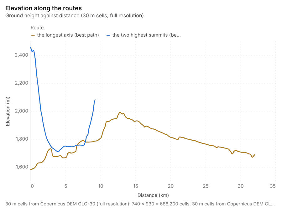
The automatic terrain analysis of an area, with no model call: every terrain tool, with observers, lines of sight, routes and radio sites it places itself, then the charts (hypsometric curve, slope distribution, aspect rose, elevation along the routes), the dominant heights, the cited findings and the seven terrain maps the Terrain page, the chat and the exports share.
Terrain analysis (everything) of 619.4 km2 at 30 m cells (full resolution), 29 terrain tool(s) in 35 call(s): elevation 1,562 to 2,456 m (894 m of relief), mean slope 5.2 degrees, 6.9% steeper than 15 degrees; 55 finding(s): Dominant heights; Key terrain candidate KT-1; Key terrain candidate KT-2.
619 km2analyzed
30 mcells
1,562 to 2,456 melevation
894 mrelief
5.2 degreesmean slope
29analyses
The terrain maps
Charts
Numbers
| Measure | Value |
|---|---|
| area_km2 | 619.4 |
| elevation_min_m | 1,562 |
| elevation_max_m | 2,456 |
| relief_m | 894.3 |
| hypsometric_integral | 0.293 |
| mean_slope_deg | 5.17 |
| steeper_than_15_pct | 6.89 |
| flat_pct | 14.26 |
| flood_prone_pct | 11.27 |
| key_terrain | 10 |
| chokepoints | 92 |
| corridors | 47 |
| dominant_heights | 5 |
| findings | 55 |
| charts | 4 |
| layers | 85 |
| steps_run | 34 |
| steps_failed | 0 |
| tools_run | 29 |
| calls_skipped | 0 |
Findings
- Relief and steepness
- Dominant heights
- Key terrain candidate KT-1
- Key terrain candidate KT-2
- Key terrain candidate KT-3
- Widest mobility corridor
- Avenue AA-1
- Avenue AA-2
- Chokepoint CP-1
- Chokepoint CP-2
- Chokepoint CP-3
- Flood-prone ground
- Facing
- View from the dominant heights