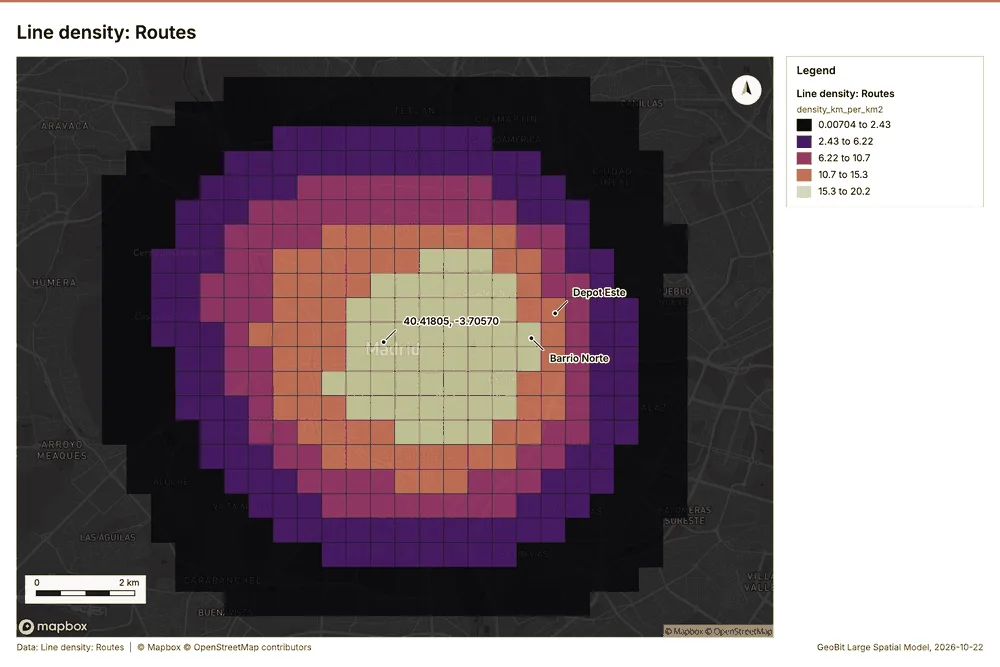
Line density
gp_line_density
What it does
Length of lines per unit area around each cell (km per square km), optionally weighted by a field.
The ArcGIS Pro tools it stands for
- Line Density (Spatial Analyst, Density)
From the product's Esri parity register.
Logistics Madrid, Spain
1 call succeeded. 1 output layer on the sample's interactive map.