Spatial join

gp_spatial_join

GIS analysisran in 3 samples10 images
What it does

Attach attributes (or aggregates) of matching features from another layer, by location, distance, time and attributes.

The ArcGIS Pro tools it stands for

  • Spatial Join (Analysis, Overlay)
  • Add Spatial Join (Data Management, Joins and Relates)
  • Transfer Attributes (Editing, Conflation, partial)
  • Join Features (Other toolboxes, GeoAnalytics Desktop)

From the product's Esri parity register.

Public safety Chicago, Illinois, United States

2 calls succeeded. 2 output layers on the sample's interactive map.
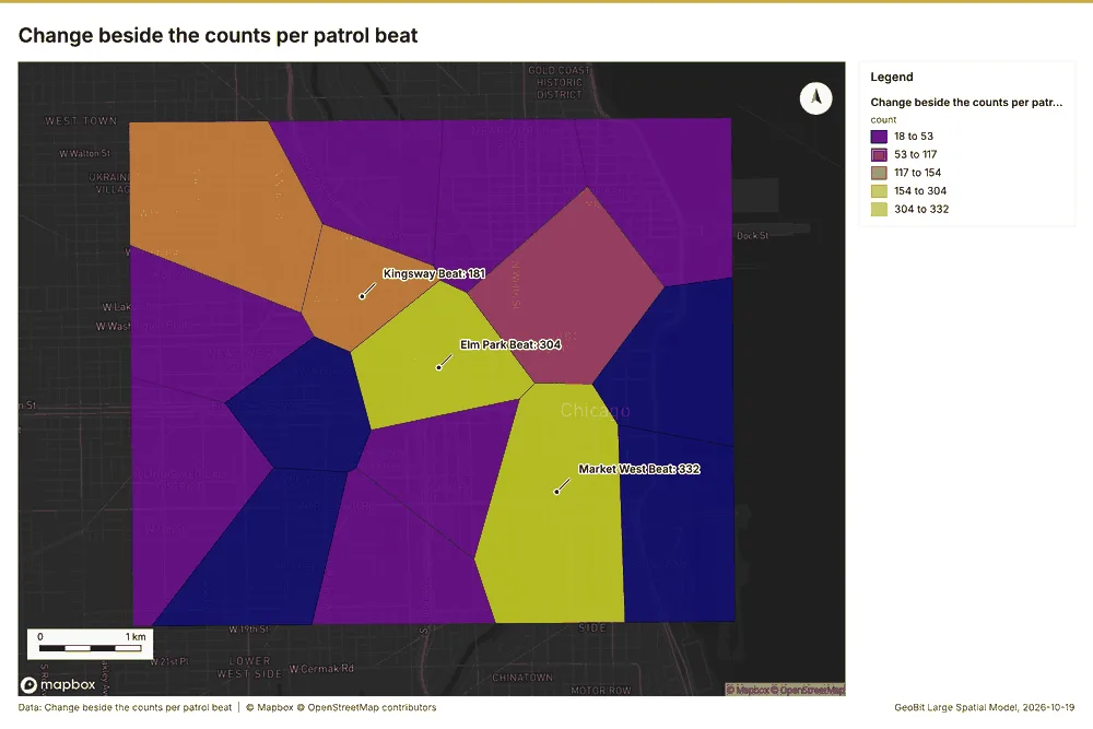
Change beside the counts per patrol beat
Change beside the counts per patrol beatmap
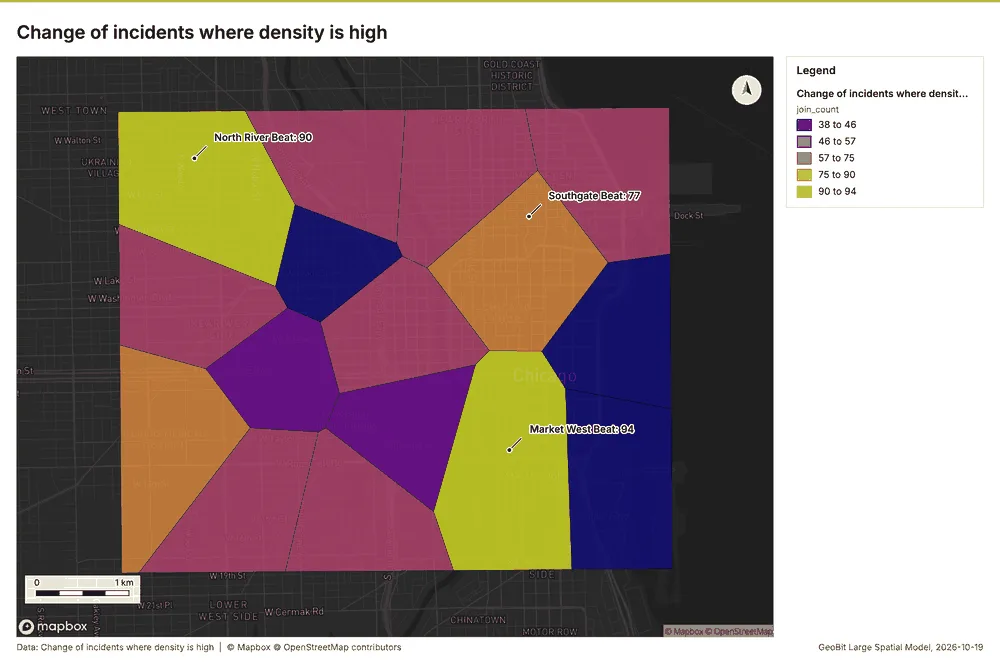
Change of incidents where density is high
Change of incidents where density is highmap
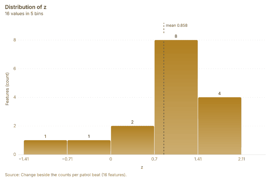
Change beside the counts per patrol beat
Change beside the counts per patrol beatchart
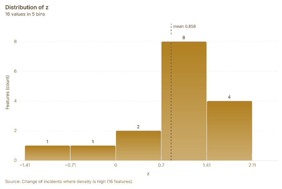
Change of incidents where density is high
Change of incidents where density is highchart

Telecom Medellin, Antioquia, Colombia

2 calls succeeded. 2 output layers on the sample's interactive map.
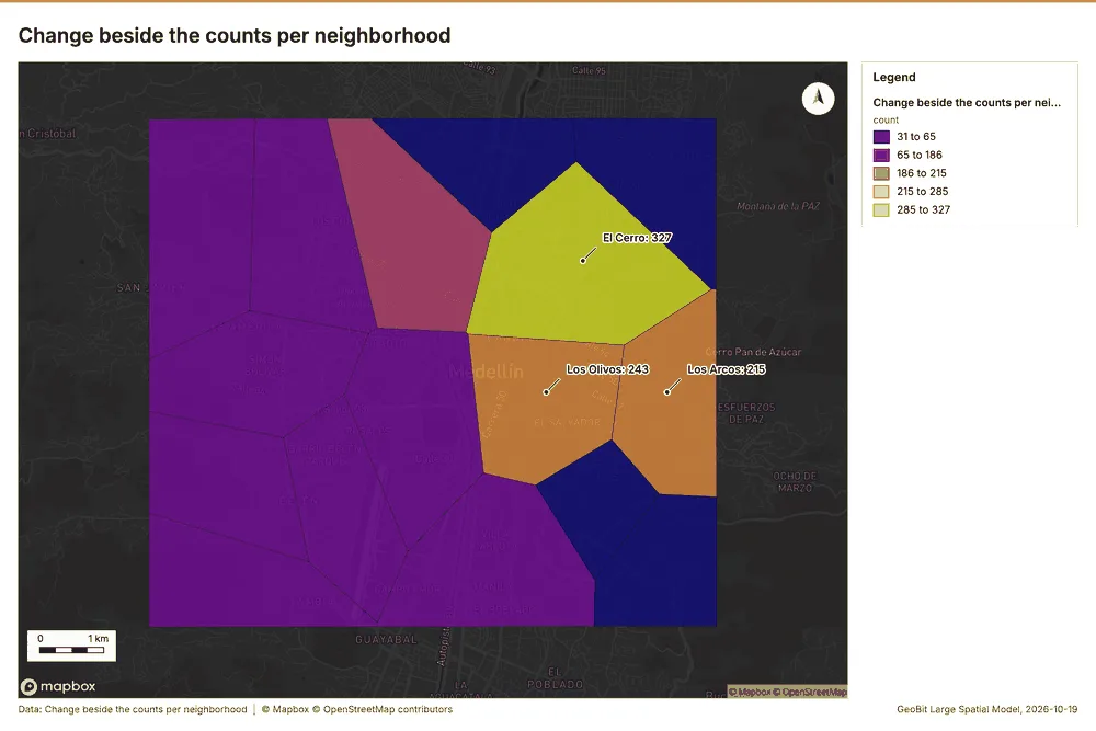
Change beside the counts per neighborhood
Change beside the counts per neighborhoodmap
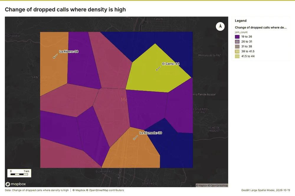
Change of dropped calls where density is high
Change of dropped calls where density is highmap

Public health Kampala, Uganda

2 calls succeeded. 2 output layers on the sample's interactive map.
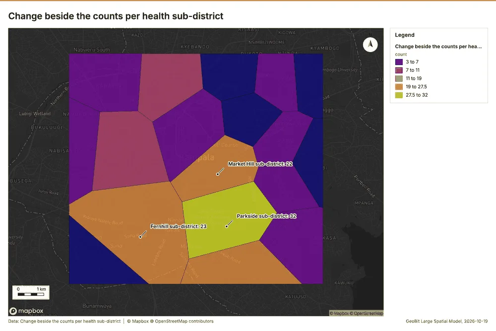
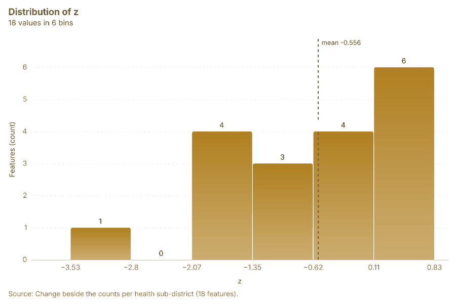
Change beside the counts per health sub-district
Change beside the counts per health sub-districtmap
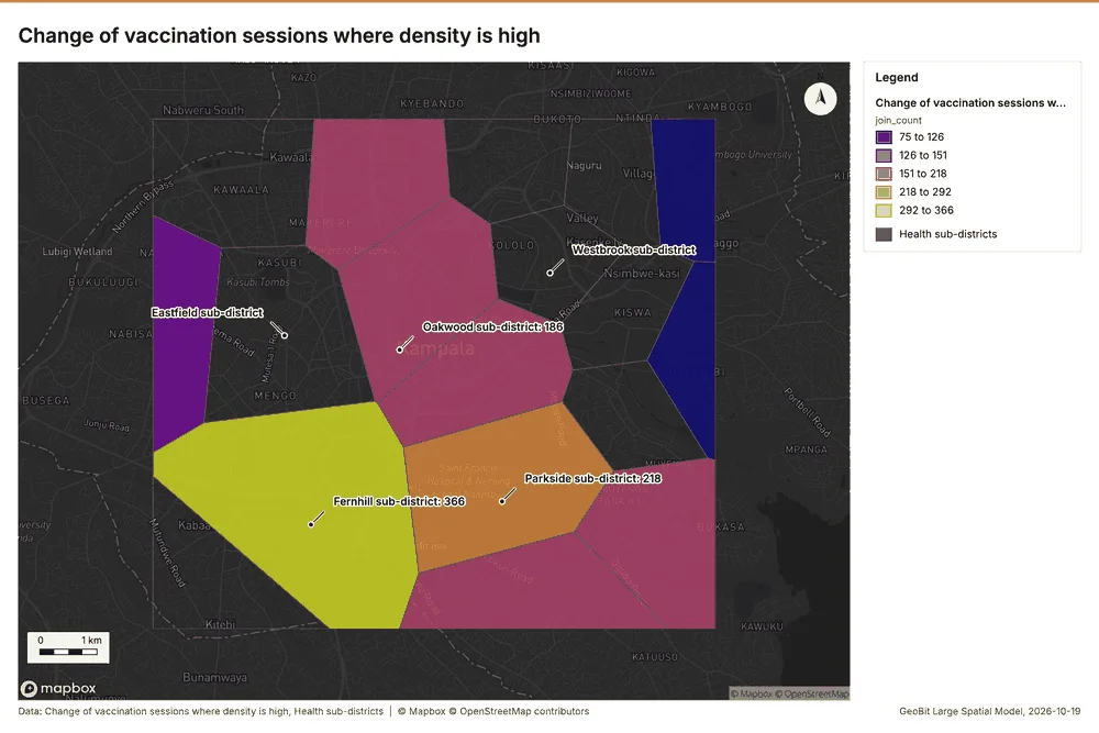
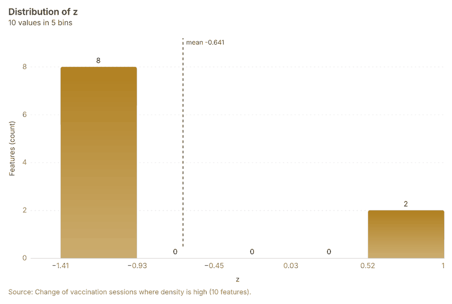
Change of vaccination sessions where density is high
Change of vaccination sessions where density is highmap
Change beside the counts per health sub-district
Change beside the counts per health sub-districtchart
Change of vaccination sessions where density is high
Change of vaccination sessions where density is highchart